Accurate aerial data for commercial properties, construction projects, and facilities across Middle Tennessee.
✔ Veteran-Owned
✔ FAA Part 107 Certified
✔ Fully Insured
✔ Based in Morrison, TN

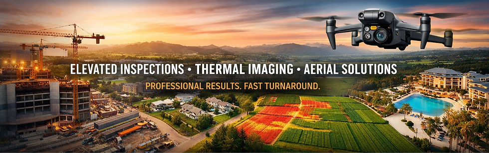
Professional Drone Inspections, Documentation & Mapping
Our Services
About HighGround Aerial Services
1
High Ground Aerial delivers professional drone services for businesses that need clear, usable aerial information—not just photos.
Our work is focused on safety, compliance, and consistent results.
Our Core Drone Services
2
Roof & Property Inspections
Fast, safe aerial inspections that document roof conditions and property assets without ladders, lifts, or disruption.
Construction Progress Documentation
Consistent aerial updates that help contractors, developers, and stakeholders track progress and communicate clearly.
Mapping & 3D Modeling
Accurate aerial maps and models created using photogrammetry for planning, measurement, and documentation.
Commercial Aerial Imaging
Professional aerial imagery for facilities, properties, and business documentation.
Who We Work With
3
-
Property owners & managers
-
Contractors & developers
-
Facility and operations teams
-
Commercial decision-makers